Here’s how we made the four-square chart:
The students took a blank paper, folded it in half “hamburger style,” unfolded the paper and refolded it “hotdog style.” When they opened their paper, they saw it was divided into four squares.
Here’s what info went into each square:
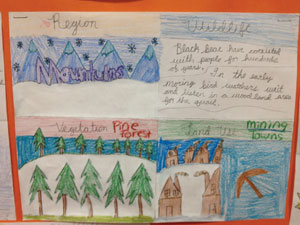
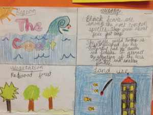
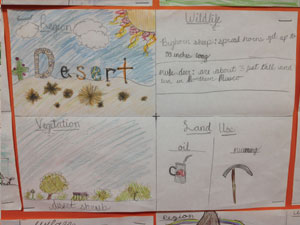
Square 1: The students wrote which region they chose to research. I told them to write their region in bubble letters and create a picture to go around the title.
Square 2: The students were asked to research and draw the different wildlife that can be found in their region.
Square 3: The students researched, drew, and labeled vegetation present in the region they chose.
Square 4: The students researched and drew pictures of how the region’s land is used.
This was a great extension activity that my students really enjoyed. Here's what the finished products looks like.


To see more activities click here.


No comments:
Post a Comment